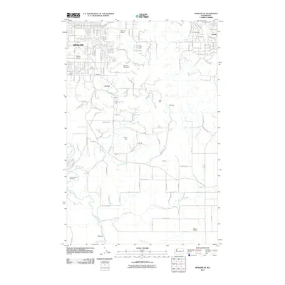
2011 Map of Spokane SE
USGS Topo · Published 2011About this map
Spokane's southeastern residential fringes meet the rising terrain of the Palouse in this 2011 survey, showing a transition from dense street grids to more open rural landscapes. The northern portion of the map is defined by the development of Moran Prairie and Glenrose Prairie, where established neighborhoods like Piedmont and Parkview sit alongside prominent religious and community landmarks such as the Immaculate Heart Retreat and the Moran Cemetery. As the topography ascends toward the east, significant natural features such as Browne Mountain and Krell Hill dominate the landscape, providing a physical buffer to the more sparsely settled areas near Kiesling and Sharon.
Find a feature on this map
115 named features on this map. Tap any name to fly to it.
Don’t see what you’re looking for? This feature index may not catch every label — zoom into the map to look around manually.
Map Details
Editions of this 2011 Spokane SE Map
This is the sole edition of this map. No revisions or reprints were ever made.
Other maps of this area

1901 · Spokane
USGS Topo · 1:125,000

1903 · Oakesdale
USGS Topo · 1:125,000

1905 · Oakesdale
USGS Topo · 1:125,000

1949 · Greenacres
USGS Topo · 1:62,500

1950 · Spokane NE
USGS Topo · 1:24,000

1950 · Spokane SE
USGS Topo · 1:24,000

1950 · Spokane SW
USGS Topo · 1:24,000

1950 · Spokane NW
USGS Topo · 1:24,000

1950 · Spokane
USGS Topo · 1:62,500

1951 · Greenacres
USGS Topo · 1:62,500