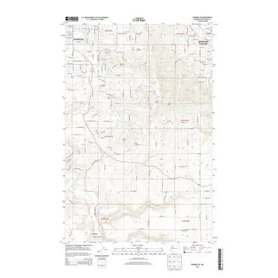
2014 Map of Spokane SE
USGS Topo · Published 2014About this map
Browne Mtn and Krell Hill dominate the central relief of this 2014 Spokane County survey, marking the transition from the city's suburban fringes into the rolling agricultural landscapes to the south. The map documents the persistent identity of historical communities like Glenrose Prairie and Moran Prairie, where residential development meets the steep slopes of Big Rock. Genealogists will find the Moran Cem and Wood Memorial Cem clearly marked, alongside institutions like the Immaculate Heart Retreat. The drainage patterns of Hangman Creek, Stevens Cr, and California Cr define the lower elevations, where the landscape opens into the rural areas of Sharon and Excelsior. This layout preserves the spatial relationship between older settlements like Kiesling and the expanding road network of Spokane and Spokane Valley.
Find a feature on this map
79 named features on this map. Tap any name to fly to it.
Don’t see what you’re looking for? This feature index may not catch every label — zoom into the map to look around manually.
Map Details
Editions of this 2014 Spokane SE Map
This is the sole edition of this map. No revisions or reprints were ever made.
Other maps of this area

1901 · Spokane
USGS Topo · 1:125,000

1903 · Oakesdale
USGS Topo · 1:125,000

1905 · Oakesdale
USGS Topo · 1:125,000

1949 · Greenacres
USGS Topo · 1:62,500

1950 · Spokane NE
USGS Topo · 1:24,000

1950 · Spokane SE
USGS Topo · 1:24,000

1950 · Spokane SW
USGS Topo · 1:24,000

1950 · Spokane NW
USGS Topo · 1:24,000

1950 · Spokane
USGS Topo · 1:62,500

1951 · Greenacres
USGS Topo · 1:62,500