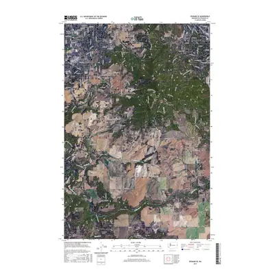
2017 Map of Spokane SE
USGS Topo · Published 2017About this map
Moran Prairie and Glenrose Prairie define the transition from the expanding city of Spokane to the higher elevations of the southeast. The landscape is characterized by prominent peaks like Browne Mtn, Krell Hill, and Silver Hill, which overlook the developing suburban fringe and remaining open spaces. The map reveals a dense network of residential streets in the northwest, contrasting with the more dispersed rural routes and homesteads near the Chester area and the southern reaches near Duncan.
Find a feature on this map
133 named features on this map. Tap any name to fly to it.
Don’t see what you’re looking for? This feature index may not catch every label — zoom into the map to look around manually.
Map Details
Editions of this 2017 Spokane SE Map
This is the sole edition of this map. No revisions or reprints were ever made.
Other maps of this area

1901 · Spokane
USGS Topo · 1:125,000

1903 · Oakesdale
USGS Topo · 1:125,000

1905 · Oakesdale
USGS Topo · 1:125,000

1949 · Greenacres
USGS Topo · 1:62,500

1950 · Spokane NE
USGS Topo · 1:24,000

1950 · Spokane SE
USGS Topo · 1:24,000

1950 · Spokane SW
USGS Topo · 1:24,000

1950 · Spokane NW
USGS Topo · 1:24,000

1950 · Spokane
USGS Topo · 1:62,500

1951 · Greenacres
USGS Topo · 1:62,500