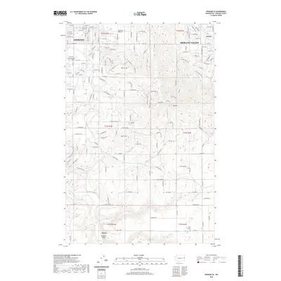
2020 Map of Spokane SE
USGS Topo · Published 2020About this map
Browne Mtn and Krell Hill dominate the topography southeast of Spokane, where the city's suburban expansion meets the high prairie and steep ridges of eastern Washington. This 2020 survey illustrates the developed residential street grids of Spokane Valley and Moran Prairie giving way to the more open landscapes of Glenrose Prairie and Silver Hill. Significant drainages such as Stevens Cr and California Cr cut through the terrain, flowing toward the prominent Hangman Creek valley in the southwest. For those interested in local history, the map identifies established sites like the Moran Cemetery and Wood Memorial Cemetery, alongside smaller named localities like Chester and Duncan. The map documents a complex network of named roads, including E Gibbs Rd and E 57th Ave, which serve as the arteries for recent growth in this transition zone between urban centers and rural uplands.
Find a feature on this map
140 named features on this map. Tap any name to fly to it.
Don’t see what you’re looking for? This feature index may not catch every label — zoom into the map to look around manually.
Map Details
Editions of this 2020 Spokane SE Map
This is the sole edition of this map. No revisions or reprints were ever made.
Other maps of this area

1901 · Spokane
USGS Topo · 1:125,000

1903 · Oakesdale
USGS Topo · 1:125,000

1905 · Oakesdale
USGS Topo · 1:125,000

1949 · Greenacres
USGS Topo · 1:62,500

1950 · Spokane NE
USGS Topo · 1:24,000

1950 · Spokane SE
USGS Topo · 1:24,000

1950 · Spokane SW
USGS Topo · 1:24,000

1950 · Spokane NW
USGS Topo · 1:24,000

1950 · Spokane
USGS Topo · 1:62,500

1951 · Greenacres
USGS Topo · 1:62,500