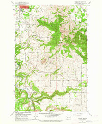
1963 Map of Spokane SE
USGS Topo · Published 1964About this map
Moran Prairie dominates the landscape south of Spokane in the early 1960s, showing a community defined by its radio infrastructure and evolving education system. The presence of numerous broadcasting sites, including the Radio Towers (KREM) and Radio Tower (KCFA), highlights the area's role as a regional communications hub. The map captures local landmarks like Ferris High Sch and Adams Sch alongside spiritual and social centers such as the Immaculate Heart Retreat and the local Grange Hall.
Find a feature on this map
56 named features on this map. Tap any name to fly to it.
Don’t see what you’re looking for? This feature index may not catch every label — zoom into the map to look around manually.
Map Details
Editions of this 1963 Spokane SE Map
This is the sole edition of this map. No revisions or reprints were ever made.
Other maps of this area

1901 · Spokane
USGS Topo · 1:125,000

1903 · Oakesdale
USGS Topo · 1:125,000

1905 · Oakesdale
USGS Topo · 1:125,000

1949 · Greenacres
USGS Topo · 1:62,500

1950 · Spokane NE
USGS Topo · 1:24,000

1950 · Spokane SE
USGS Topo · 1:24,000

1950 · Spokane SW
USGS Topo · 1:24,000

1950 · Spokane NW
USGS Topo · 1:24,000

1950 · Spokane
USGS Topo · 1:62,500

1951 · Greenacres
USGS Topo · 1:62,500