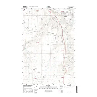
2017 Map of Spokane SW
USGS Topo · Published 2017About this map
Hangman Creek and its surrounding Hangman Valley dominate the eastern landscape of this portion of Spokane County, where the city of Spokane transitions into more rural terrain. The map documents the southwestern suburban expansion and specialized land use, including the Spokane Memorial Gardens and small airfields like Homeport Airport and Fowlers Northwest 40 Airport. Transport infrastructure is a central theme, with the BNSF Railway corridor and a dense grid of local roads serving established communities.
Find a feature on this map
179 named features on this map. Tap any name to fly to it.
Don’t see what you’re looking for? This feature index may not catch every label — zoom into the map to look around manually.
Map Details
Editions of this 2017 Spokane SW Map
This is the sole edition of this map. No revisions or reprints were ever made.
Other maps of this area

1901 · Spokane
USGS Topo · 1:125,000

1903 · Oakesdale
USGS Topo · 1:125,000

1905 · Oakesdale
USGS Topo · 1:125,000

1943 · Medical Lake
USGS Topo · 1:62,500

1950 · Spokane NE
USGS Topo · 1:24,000

1950 · Spokane SE
USGS Topo · 1:24,000

1950 · Spokane SW
USGS Topo · 1:24,000

1950 · Spokane NW
USGS Topo · 1:24,000

1950 · Spokane
USGS Topo · 1:62,500

1954 · Airway Heights
USGS Topo · 1:24,000