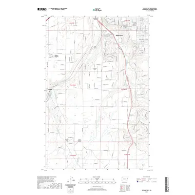
2020 Map of Spokane SW
USGS Topo · Published 2020About this map
Spokane and its southwestern reaches are defined by the winding course of Hangman Creek, which carves through the terrain toward the heart of the city. This 2020 landscape illustrates the transition from the dense urban street grid of neighborhoods like Moran Prairie to the rural expanses and scattered aviation facilities of the plateau. Several small airfields, including Homeport Airport and Ox Meadows Airport, serve the area, while the BNSF Railway tracks trace a vital transportation corridor through the town of Marshall.
Find a feature on this map
166 named features on this map. Tap any name to fly to it.
Don’t see what you’re looking for? This feature index may not catch every label — zoom into the map to look around manually.
Map Details
Editions of this 2020 Spokane SW Map
This is the sole edition of this map. No revisions or reprints were ever made.
Other maps of this area

1901 · Spokane
USGS Topo · 1:125,000

1903 · Oakesdale
USGS Topo · 1:125,000

1905 · Oakesdale
USGS Topo · 1:125,000

1943 · Medical Lake
USGS Topo · 1:62,500

1950 · Spokane NE
USGS Topo · 1:24,000

1950 · Spokane SE
USGS Topo · 1:24,000

1950 · Spokane SW
USGS Topo · 1:24,000

1950 · Spokane NW
USGS Topo · 1:24,000

1950 · Spokane
USGS Topo · 1:62,500

1954 · Airway Heights
USGS Topo · 1:24,000