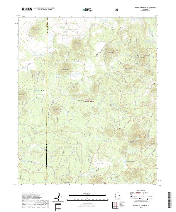
2021 Map of Sponseller Mountain
USGS Topo · Published 2021About this map
Sitgreaves National Forest defines this high-elevation landscape within the Apache and Navajo County borders. The terrain is dominated by a series of volcanic peaks and distinct knobs, including Sponseller Mtn, Ziegler Mtn, and the prominent Lake Mtn to the southeast. Water sources are critical in this environment, evidenced by a network of named tanks and springs such as Brusally Tank, Dipping Vat Spring, and Los Burros Spring.
Find a feature on this map
88 named features on this map. Tap any name to fly to it.
Don’t see what you’re looking for? This feature index may not catch every label — zoom into the map to look around manually.
Map Details
Editions of this 2021 Sponseller Mountain Map
This is the sole edition of this map. No revisions or reprints were ever made.
Other maps of this area

1886 · St Johns
USGS Topo · 1:250,000

1892 · St Johns
USGS Topo · 1:250,000

1954 · Saint Johns
USGS Topo · 1:250,000

1957 · Saint Johns
USGS Topo · 1:250,000

1958 · Saint Johns
USGS Topo · 1:250,000

1961 · McNary
USGS Topo · 1:62,500

1962 · Saint Johns
USGS Topo · 1:250,000

1968 · Boundary Butte
USGS Topo · 1:24,000
1969 · Horseshoe Cienega
USGS Topo · 1:24,000
1971 · Vernon
USGS Topo · 1:24,000