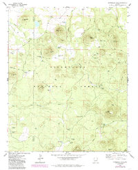
1976 Map of Sponseller Mtn.
USGS Topo · Published 1985About this map
Sitgreaves National Forest and the northern reaches of the Fort Apache Indian Res dominate this mid-1970s landscape, defined by a network of high-elevation cinder cones and water management infrastructure. The terrain is punctuated by significant volcanic peaks including Sponseller Mtn, Marshall Mtn, and Doyle Mountain, with the distinctive lookout at Lake Mountain serving as a primary landmark.
Find a feature on this map
55 named features on this map. Tap any name to fly to it.
Don’t see what you’re looking for? This feature index may not catch every label — zoom into the map to look around manually.
Map Details
Editions of this 1976 Sponseller Mtn. Map
2 editions found
Other maps of this area

1886 · St Johns
USGS Topo · 1:250,000

1892 · St Johns
USGS Topo · 1:250,000

1954 · Saint Johns
USGS Topo · 1:250,000

1957 · Saint Johns
USGS Topo · 1:250,000

1958 · Saint Johns
USGS Topo · 1:250,000

1961 · McNary
USGS Topo · 1:62,500

1962 · Saint Johns
USGS Topo · 1:250,000

1968 · Boundary Butte
USGS Topo · 1:24,000
1969 · Horseshoe Cienega
USGS Topo · 1:24,000
1971 · Vernon
USGS Topo · 1:24,000