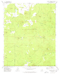
1977 Map of Sponseller Mtn.
USGS Topo · Published 1978About this map
Sponseller Mtn and Ziegler Mtn anchor the northern reaches of this high-elevation landscape within the Sitgreaves National Forest. The 1977 terrain is defined by a complex network of water sources, from Sponseller Lake and Hidden Lake to numerous livestock tanks such as Penrod Tank and Marshall Tank. The boundary between Navajo and Apache Counties bisects the map, showing the division of administrative jurisdictions across these forested uplands. In the southern portion, the map transitions into the Fort Apache Indian Reservation, where features like Los Burros and Danstone Springs appear alongside Lake Mountain. The presence of the Mc Nary Vernon Road and various fire roads and jeep trails suggests a landscape managed for both timber and ranching, evidenced by the scattered springs and a Cinder Pit near the reservation border.
Find a feature on this map
60 named features on this map. Tap any name to fly to it.
Don’t see what you’re looking for? This feature index may not catch every label — zoom into the map to look around manually.
Map Details
Editions of this 1977 Sponseller Mtn. Map
This is the sole edition of this map. No revisions or reprints were ever made.
Other maps of this area

1886 · St Johns
USGS Topo · 1:250,000

1892 · St Johns
USGS Topo · 1:250,000

1954 · Saint Johns
USGS Topo · 1:250,000

1957 · Saint Johns
USGS Topo · 1:250,000

1958 · Saint Johns
USGS Topo · 1:250,000

1961 · McNary
USGS Topo · 1:62,500

1962 · Saint Johns
USGS Topo · 1:250,000

1968 · Boundary Butte
USGS Topo · 1:24,000
1969 · Horseshoe Cienega
USGS Topo · 1:24,000
1971 · Vernon
USGS Topo · 1:24,000