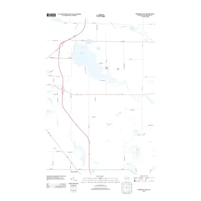
2013 Map of Spooner Lake
USGS Topo · Published 2013About this map
Spooner Lake and its intricate shoreline dominate this portion of Washburn County, surrounded by a dense network of smaller glacial lakes and marshlands. The landscape is defined by its water, from the winding path of Potato Creek and the Yellow River to the isolated basins of Schullenberger Lake and Deep Lake. In the small settlement of Beaver Brook, the intersection of Us-53 and Wi-70 serves as a modern transportation hub, while more specialized landmarks like the Nest of Eagles Airport near Crystal Mtn suggest a mix of local aviation and recreation. This 2013 survey provides a detailed look at the rural road system, including named routes like Cranberry Dr and Yellowsands Dr, which trace the irregular terrain of the lake country. Genealogists and local historians can use these specific road names and landmarks, such as Anah Springs and Lutz Lake, to locate family properties and community sites within the north-woods landscape.
Find a feature on this map
61 named features on this map. Tap any name to fly to it.
Don’t see what you’re looking for? This feature index may not catch every label — zoom into the map to look around manually.
Map Details
Editions of this 2013 Spooner Lake Map
This is the sole edition of this map. No revisions or reprints were ever made.
Other maps of this area

1948 · Spooner
USGS Topo · 1:48,000

1948 · Stone Lake
USGS Topo · 1:48,000

1949 · Spooner
USGS Topo · 1:48,000

1949 · Rice Lake
USGS Topo · 1:48,000

1950 · Stone Lake
USGS Topo · 1:48,000

1951 · Shell Lake
USGS Topo · 1:48,000

1951 · Rice Lake
USGS Topo · 1:48,000

1953 · Rice Lake
USGS Topo · 1:250,000

1959 · Rice Lake
USGS Topo · 1:250,000

1965 · Rice Lake
USGS Topo · 1:62,500