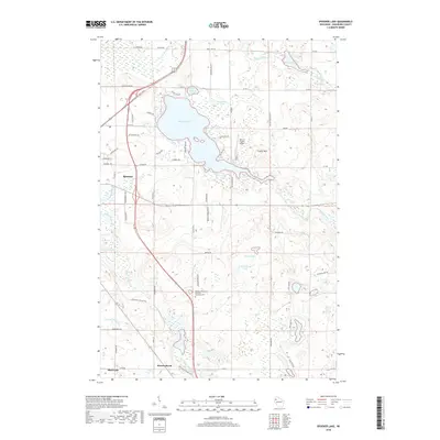
2018 Map of Spooner Lake
USGS Topo · Published 2018About this map
Spooner Lake and the surrounding Washburn County wetlands dominate this 2018 survey, illustrating a landscape defined by glacial topography and modern recreation. The northern reaches of the city of Spooner are visible, showing a corridor of development that transitions into the extensive trail systems and water bodies of northern Wisconsin. The Wild Rivers State Trail follows a clear linear path through the terrain, cutting past the Northern Wisconsin Veterans Memorial Cem and south toward Beaver Brook. Local aviation and elevation are represented by the Nest of Eagles Airport situated near Crystal Mtn. This map captures the intricate drainage patterns of the region, where Little Mackay Cr, Crystal Brook, and Potato Creek weave between numerous named basins like Schullenberger Lake and Holmes Lake, providing a clear record of the area's contemporary geography and land use.
Find a feature on this map
72 named features on this map. Tap any name to fly to it.
Don’t see what you’re looking for? This feature index may not catch every label — zoom into the map to look around manually.
Map Details
Editions of this 2018 Spooner Lake Map
This is the sole edition of this map. No revisions or reprints were ever made.
Other maps of this area

1948 · Spooner
USGS Topo · 1:48,000

1948 · Stone Lake
USGS Topo · 1:48,000

1949 · Spooner
USGS Topo · 1:48,000

1949 · Rice Lake
USGS Topo · 1:48,000

1950 · Stone Lake
USGS Topo · 1:48,000

1951 · Shell Lake
USGS Topo · 1:48,000

1951 · Rice Lake
USGS Topo · 1:48,000

1953 · Rice Lake
USGS Topo · 1:250,000

1959 · Rice Lake
USGS Topo · 1:250,000

1965 · Rice Lake
USGS Topo · 1:62,500