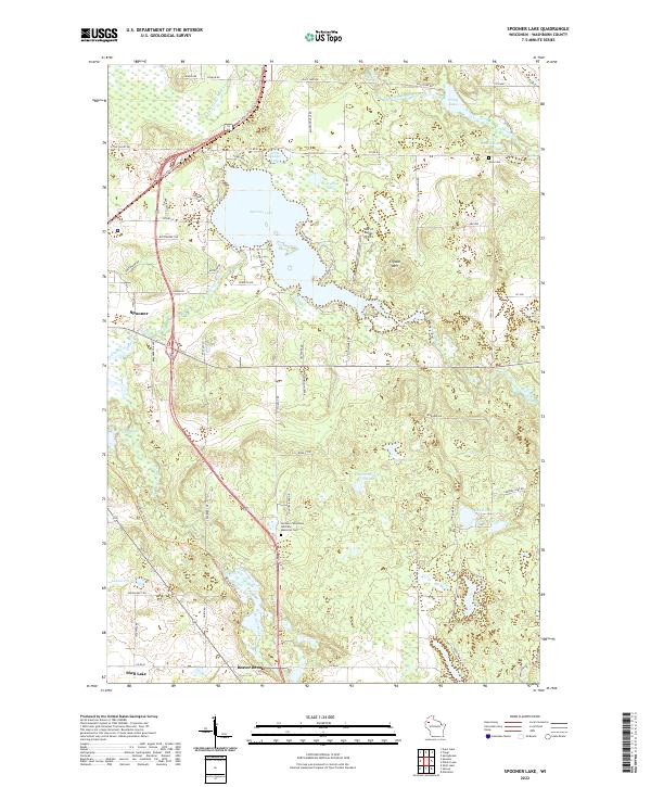
2022 Map of Spooner Lake
USGS Topo · Published 2022About this map
Spooner Lake and the surrounding Washburn County wetlands define this landscape, where the Yellow River and Potato Creek flow through a complex network of glacial lakes and springs. The area is anchored by the settlement of Spooner and the Northern Wisconsin Veterans Memorial Cem, which sits near the southern marshes. The terrain is notably varied, featuring the rise of Crystal Mtn and the specialized Nest of Eagles Airport located east of the lake.
Find a feature on this map
71 named features on this map. Tap any name to fly to it.
Don’t see what you’re looking for? This feature index may not catch every label — zoom into the map to look around manually.
Map Details
Editions of this 2022 Spooner Lake Map
This is the sole edition of this map. No revisions or reprints were ever made.
Other maps of this area

1948 · Spooner
USGS Topo · 1:48,000

1948 · Stone Lake
USGS Topo · 1:48,000

1949 · Spooner
USGS Topo · 1:48,000

1949 · Rice Lake
USGS Topo · 1:48,000

1950 · Stone Lake
USGS Topo · 1:48,000

1951 · Shell Lake
USGS Topo · 1:48,000

1951 · Rice Lake
USGS Topo · 1:48,000

1953 · Rice Lake
USGS Topo · 1:250,000

1959 · Rice Lake
USGS Topo · 1:250,000

1965 · Rice Lake
USGS Topo · 1:62,500