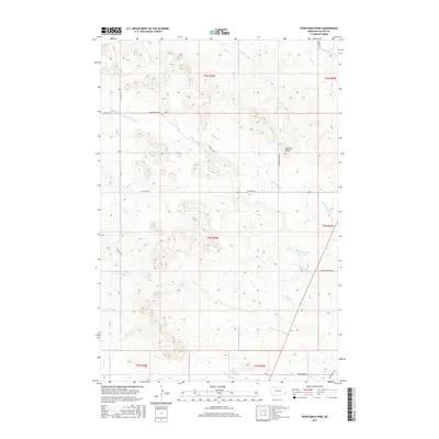
2017 Map of Sportsman Pond
USGS Topo · Published 2017About this map
Sportsman Pond serves as a focal point in this high-plains landscape of eastern Montana, where the drainage networks of several creek systems converge. The terrain is defined by its watercourses, including the southward flow of Milk Creek and the meandering Lame Jones Creek, which passes near the prominent Bearhorn Butte. This 2017 survey reveals a classic section-line road grid typical of the American West, punctuated by naming conventions that reflect local geography and land ownership, such as Bergstrom Hill Rd and Scorio Butte Rd. The presence of the Old Baker Hwy in the southeastern corner suggests the historical transit corridors connecting this rural area to larger regional hubs. The intricate network of intermittent streams like Duck Creek and North Fork of Dry Creek illustrates the complex hydrology of the Fallon County uplands.
Find a feature on this map
24 named features on this map. Tap any name to fly to it.
Don’t see what you’re looking for? This feature index may not catch every label — zoom into the map to look around manually.
Map Details
Editions of this 2017 Sportsman Pond Map
This is the sole edition of this map. No revisions or reprints were ever made.
Other maps of this area

1953 · Miles City
USGS Topo · 1:250,000

1957 · Miles City
USGS Topo · 1:250,000

1958 · Miles City
USGS Topo · 1:250,000

1981 · Baker
USGS Topo · 1:100,000

1981 · Baker
USGS Topo · 1:24,000

1981 · South Sandstone Reservoir
USGS Topo · 1:24,000

1981 · Willard
USGS Topo · 1:24,000
1981 · Willard SE
USGS Topo · 1:24,000

1981 · Little Pine Creek
USGS Topo · 1:24,000

1981 · Seven-Up Butte
USGS Topo · 1:24,000