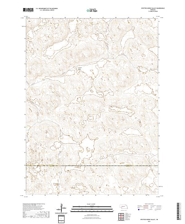
2021 Map of Spotted Horse Valley
USGS Topo · Published 2021About this map
Spotted Horse Valley defines the core of this western Nebraska landscape, where the sandhills of the Platte River valley meet the high plains. This 2021 survey details a region dominated by ranching and large-scale land divisions, spanning the border between Arthur and Keith counties. The topography is shaped by the characteristic depressions and rises of the Nebraska Sandhills, with access provided by a network of rural routes including Packard Rd and Enfield Rd. For those researching local land use or genealogy in the northern reaches of the Panhandle, the map provides precise locations for contemporary infrastructure like Keystone Rd and Rd East G N, illustrating how these remote corridors connect scattered homesteads and ranching operations across several townships.
Find a feature on this map
13 named features on this map. Tap any name to fly to it.
Don’t see what you’re looking for? This feature index may not catch every label — zoom into the map to look around manually.
Map Details
Editions of this 2021 Spotted Horse Valley Map
This is the sole edition of this map. No revisions or reprints were ever made.
Other maps of this area

1897 · Ogallala
USGS Topo · 1:125,000

1898 · Paxton
USGS Topo · 1:125,000

1900 · Ogallala
USGS Topo · 1:125,000

1901 · Paxton
USGS Topo · 1:125,000

1949 · Arthur
USGS Topo · 1:62,500

1949 · Flats
USGS Topo · 1:62,500

1950 · Flats
USGS Topo · 1:62,500

1950 · Arthur
USGS Topo · 1:62,500

1954 · North Platte
USGS Topo · 1:250,000

1956 · North Platte
USGS Topo · 1:250,000