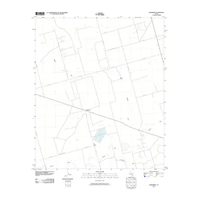
2010 Map of Spraberry
USGS Topo · Published 2010About this map
Spraberry stands at the center of this 2010 survey, representing a landscape defined by industrial and ranching activity in Midland County. The map details a geometric grid of rural routes, including Fm 1379 and several county roads like E Co Rd 160, which navigate the arid terrain. This area is characterized by ephemeral drainage systems such as Midland Draw, Johnson Draw, and Pemberton Draw, which carve through the plains. The presence of Tex-Harvey Camp and Boone Ranch illustrates the dual nature of land use in this part of West Texas, where oil and gas production facilities often exist alongside traditional ranching operations. The road network provides clear evidence of the infrastructure required to support these rural industries, connecting remote outposts across the Permian Basin landscape.
Find a feature on this map
20 named features on this map. Tap any name to fly to it.
Don’t see what you’re looking for? This feature index may not catch every label — zoom into the map to look around manually.
Map Details
Editions of this 2010 Spraberry Map
This is the sole edition of this map. No revisions or reprints were ever made.
Other maps of this area

1941 · Morita
USGS Topo · 1:62,500

1949 · Morita
USGS Topo · 1:62,500

1954 · Big Spring
USGS Topo · 1:250,000

1954 · San Angelo
USGS Topo · 1:250,000

1958 · San Angelo
USGS Topo · 1:250,000

1958 · Big Spring
USGS Topo · 1:250,000

1965 · San Angelo
USGS Topo · 1:250,000

1965 · Dewey Lake
USGS Topo · 1:24,000

1965 · Spraberry
USGS Topo · 1:24,000

1965 · Salt Lake
USGS Topo · 1:24,000