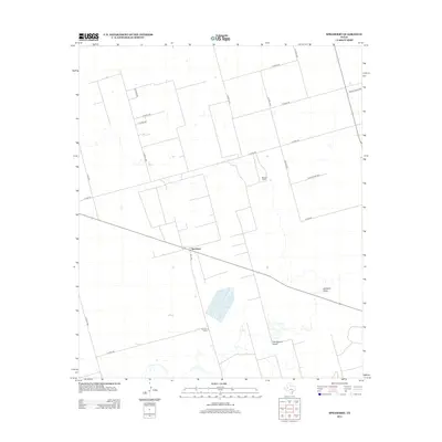
2012 Map of Spraberry
USGS Topo · Published 2012About this map
Spraberry and its surrounding ranchlands are characterized by a network of rural roads and drainage patterns typical of the Permian Basin region of West Texas. This 2012 survey illustrates the dispersed settlement of the area, centered around the community of Spraberry and the Tex-Harvey Camp, reflecting the deep connection between the landscape and local energy development. The terrain is marked by seasonal watercourses like Midland Draw and Pemberton Draw, which provide the primary relief in an otherwise flat, surveyed grid of county roads. Large landholdings such as the Boone Ranch are prominent features, alongside a dense infrastructure of private roads and state routes like Fm-1379 that facilitate transit across Midland County.
Find a feature on this map
21 named features on this map. Tap any name to fly to it.
Don’t see what you’re looking for? This feature index may not catch every label — zoom into the map to look around manually.
Map Details
Editions of this 2012 Spraberry Map
This is the sole edition of this map. No revisions or reprints were ever made.
Other maps of this area

1941 · Morita
USGS Topo · 1:62,500

1949 · Morita
USGS Topo · 1:62,500

1954 · Big Spring
USGS Topo · 1:250,000

1954 · San Angelo
USGS Topo · 1:250,000

1958 · San Angelo
USGS Topo · 1:250,000

1958 · Big Spring
USGS Topo · 1:250,000

1965 · San Angelo
USGS Topo · 1:250,000

1965 · Dewey Lake
USGS Topo · 1:24,000

1965 · Spraberry
USGS Topo · 1:24,000

1965 · Salt Lake
USGS Topo · 1:24,000