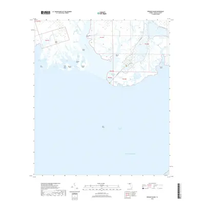
2018 Map of Sprague Island
USGS Topo · Published 2018About this map
The Saint Marks River delta and the marshy coast of Wakulla County are meticulously detailed in this recent coastal survey. The landscape is dominated by a complex network of brackish bayous, creeks, and pools, including Stony Bayou Pool and Mounds Pool. Navigation through this environment is traced via the winding Lighthouse Rd, which leads toward the coastal tip near Lighthouse Pool. Numerous islands such as Sprague Island, Gibbs Island, and Johns Island define the fragmented shoreline, separated by passages like Big Pass and Little Pass. For those exploring the wilderness, the Florida National Scenic Trail cuts through the northeast corner, while the Tower Pond Trail provides access to interior wetlands like Headquarters Pond and Picnic Pond.
Find a feature on this map
56 named features on this map. Tap any name to fly to it.
Don’t see what you’re looking for? This feature index may not catch every label — zoom into the map to look around manually.
Map Details
Editions of this 2018 Sprague Island Map
This is the sole edition of this map. No revisions or reprints were ever made.
Other maps of this area

1940 · Arran
USGS Topo · 1:62,500

1943 · Arran
USGS Topo · 1:62,500

1943 · Lighthouse Point
USGS Topo · 1:24,000

1945 · Lighthouse Point
USGS Topo · 1:31,680

1949 · Apalachicola
USGS Topo · 1:250,000

1954 · Sprague Island
USGS Topo · 1:24,000

1954 · St. Marks NE
USGS Topo · 1:24,000

1954 · St. Marks
USGS Topo · 1:24,000

1954 · Cobb Rocks
USGS Topo · 1:24,000

1954 · Tallahassee
USGS Topo · 1:250,000