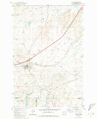
1981 Map of Sprague
USGS Topo · Published 1981About this map
Sprague serves as the central hub of this eastern Washington landscape, situated where the Burlington Northern and Union Pacific railroads converge. The town's layout is meticulously detailed, showing a cluster of residential and commercial structures south of the Sprague Airport. The surrounding terrain is characterized by a high density of water features and depressions, ranging from the elongated Fourth of July Lake on the Lincoln and Adams county line to smaller bodies like Lye Lake and Pine Tree Lake. Local history is preserved through several burial sites including Lake View Cem and Maccabee Cem west of the main settlement. The presence of numerous Gravel Pits and Borrow Pits along the rail lines and major roads like Ringwood Road suggests an active period of infrastructure maintenance and resource extraction during the early 1980s.
Find a feature on this map
27 named features on this map. Tap any name to fly to it.
Don’t see what you’re looking for? This feature index may not catch every label — zoom into the map to look around manually.
Map Details
Editions of this 1981 Sprague Map
This is the sole edition of this map. No revisions or reprints were ever made.
Other maps of this area

1953 · Ritzville
USGS Topo · 1:250,000

1954 · Sprague
USGS Topo · 1:62,500

1955 · Spokane
USGS Topo · 1:250,000

1958 · Spokane
USGS Topo · 1:250,000

1959 · Ritzville
USGS Topo · 1:250,000

1964 · Lamont NE
USGS Topo · 1:24,000

1964 · Lamont NW
USGS Topo · 1:24,000

1964 · Palm Lake
USGS Topo · 1:24,000

1965 · Ritzville
USGS Topo · 1:250,000

1969 · Sprague Lake
USGS Topo · 1:24,000