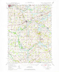
1948 Map of Spring Arbor
USGS Topo · Published 1977About this map
The North Branch Kalamazoo River and South Branch Kalamazoo River define the agricultural and hydraulic character of this southern Michigan landscape during the late 1940s. Centered on Jackson County, the area shows a dense network of one-room schoolhouses like Humphrey Sch and Stoddard Sch, many of which served small rural districts that consolidated in later decades. The New York Central railroad corridor serves as a primary transit spine, connecting established villages such as Concord, Hanover, and Spring Arbor. Local industry and social life are anchored by features like the Mill Pond and several country cemeteries including Bayn Cem and Case Cem. The presence of Mosherville Station suggests the importance of rail depots for these small communities, while numerous small water bodies like Swains Lake and the Spring Arbor Lakes highlight the glacial topography of the region.
Find a feature on this map
67 named features on this map. Tap any name to fly to it.
Don’t see what you’re looking for? This feature index may not catch every label — zoom into the map to look around manually.
Map Details
Editions of this 1948 Spring Arbor Map
2 editions found
Other maps of this area

1919 · Springport
USGS Topo · 1:62,500

1919 · Rives Junction
USGS Topo · 1:62,500

1921 · Rives Junction
USGS Topo · 1:62,500

1921 · Springport
USGS Topo · 1:62,500

1921 · Marshall
USGS Topo · 1:62,500

1923 · Marshall
USGS Topo · 1:62,500

1935 · Jackson
USGS Topo · 1:48,000

1939 · Jackson
USGS Topo · 1:62,500

1943 · Marshall
USGS Topo · 1:62,500

1948 · Spring Arbor
USGS Topo · 1:62,500