
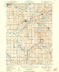
1949 Map of Spring Arbor
USGS Topo · Published 1949About this map
The North Branch Kalamazoo River and South Branch Kalamazoo River wind through this central Michigan landscape, defining a region where early rural infrastructure remained firmly intact during the late 1940s. The area is anchored by several established villages like Concord and Spring Arbor, where the New York Central railroad provided critical transit links for agricultural goods.
Find a feature on this map
65 named features on this map. Tap any name to fly to it.
Don’t see what you’re looking for? This feature index may not catch every label — zoom into the map to look around manually.
Map Details
Editions of this 1949 Spring Arbor Map
2 editions found
Other maps of this area

1919 · Springport
USGS Topo · 1:62,500

1919 · Rives Junction
USGS Topo · 1:62,500

1921 · Rives Junction
USGS Topo · 1:62,500

1921 · Springport
USGS Topo · 1:62,500

1921 · Marshall
USGS Topo · 1:62,500

1923 · Marshall
USGS Topo · 1:62,500

1935 · Jackson
USGS Topo · 1:48,000

1939 · Jackson
USGS Topo · 1:62,500

1943 · Marshall
USGS Topo · 1:62,500

1948 · Spring Arbor
USGS Topo · 1:62,500