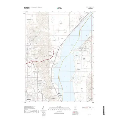
2021 Map of Spring Bay
USGS Topo · Published 2021About this map
Upper Peoria Lake dominates this stretch of the Illinois River valley, where the water expands significantly between the communities of Mossville and Spring Bay. The western shore is characterized by a series of deeply etched drainages, including Moon Hollow, Strawberry Hollow, and Boyds Hollow, which descend from the high ground near the Mount Hawley Auxiliary Airport. This 2021 record shows the suburban expansion of northern Peoria and Peoria Heights, reaching toward the educational grounds of Midstate College at Keller. On the eastern bank, the settlement of Bay View Garden and the peaceful Sand Ridge Cem sit on the alluvial plain. The map reveals the intricate road network of the contemporary era, from N Knoxville Ave to the residential drives of South Rome, while preserving the locations of early landmarks like Robinson Cem and Mount Hawley Cem.
Find a feature on this map
162 named features on this map. Tap any name to fly to it.
Don’t see what you’re looking for? This feature index may not catch every label — zoom into the map to look around manually.
Map Details
Editions of this 2021 Spring Bay Map
This is the sole edition of this map. No revisions or reprints were ever made.
Other maps of this area

1893 · Metamora
USGS Topo · 1:62,500

1893 · Dunlap
USGS Topo · 1:62,500

1898 · Dunlap
USGS Topo · 1:62,500

1905 · Peoria
USGS Topo · 1:62,500

1927 · Peoria
USGS Topo · 1:62,500

1928 · Mackinaw
USGS Topo · 1:62,500

1932 · Mackinaw
USGS Topo · 1:62,500

1932 · Dunlap
USGS Topo · 1:62,500

1933 · Dunlap
USGS Topo · 1:62,500

1937 · Metamora
USGS Topo · 1:62,500