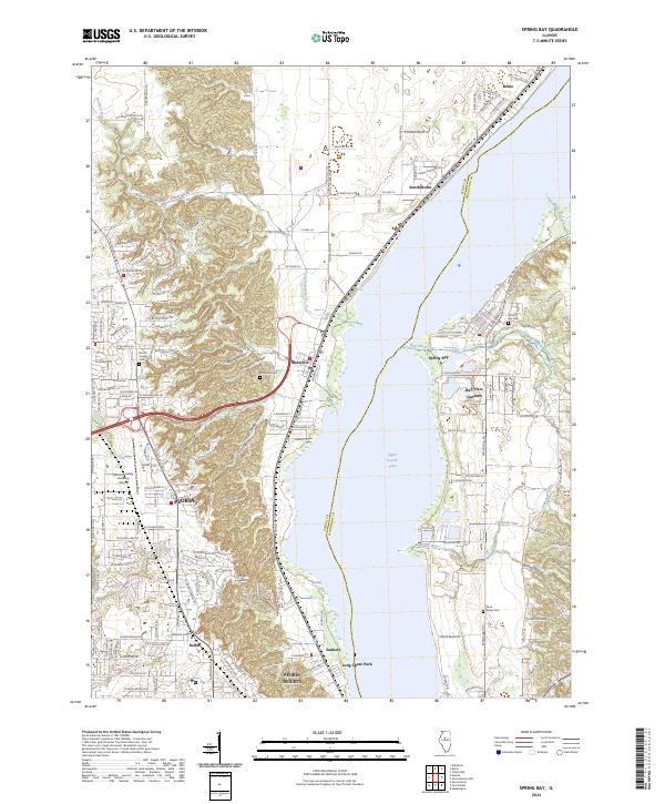
2024 Map of Spring Bay
USGS Topo · Published 2024About this map
Upper Peoria Lake dominates this central Illinois landscape, serving as a geographic divide between Peoria Co and Woodford Co. The western bank is heavily developed, showing the northern expansion of Peoria and Peoria Heights, including the commercial and residential corridors of Keller and the industrial character near Sankoty. In contrast, the eastern shore maintains a more rural, clustered settlement pattern through Spring Bay and Bay View Gardens, where the terrain transitions into the creek-carved bluffs of Burkett Hollow and Blue Creek.
Find a feature on this map
173 named features on this map. Tap any name to fly to it.
Don’t see what you’re looking for? This feature index may not catch every label — zoom into the map to look around manually.
Map Details
Editions of this 2024 Spring Bay Map
This is the sole edition of this map. No revisions or reprints were ever made.
Other maps of this area

1893 · Metamora
USGS Topo · 1:62,500

1893 · Dunlap
USGS Topo · 1:62,500

1898 · Dunlap
USGS Topo · 1:62,500

1905 · Peoria
USGS Topo · 1:62,500

1927 · Peoria
USGS Topo · 1:62,500

1928 · Mackinaw
USGS Topo · 1:62,500

1932 · Mackinaw
USGS Topo · 1:62,500

1932 · Dunlap
USGS Topo · 1:62,500

1933 · Dunlap
USGS Topo · 1:62,500

1937 · Metamora
USGS Topo · 1:62,500