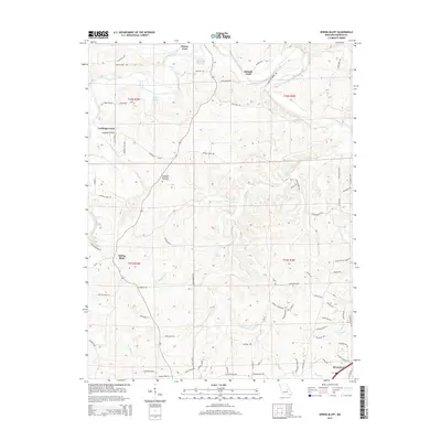
2015 Map of Spring Bluff
USGS Topo · Published 2015About this map
The Bourbeuse River snakes through the northern portion of this Franklin County landscape, creating a series of deep bends marked by historic crossing points like Peters Ford, Schmitt Ford, and Laubinger Ford. These named fords, along with numerous springs such as Roaring Spring, Kratz Spring, and Sour Spring, define a terrain heavily influenced by its hydrology. The settlement of Spring Bluff serves as a central point in this rural area, which is characterized by a dense network of ridge roads and valley lanes like Pea Ridge Rd and Wenkell Ford Rd.
Find a feature on this map
78 named features on this map. Tap any name to fly to it.
Don’t see what you’re looking for? This feature index may not catch every label — zoom into the map to look around manually.
Map Details
Editions of this 2015 Spring Bluff Map
This is the sole edition of this map. No revisions or reprints were ever made.
Other maps of this area

1903 · Sullivan
USGS Topo · 1:125,000

1934 · Meramec State Park
USGS Topo · 1:24,000

1935 · Gerald
USGS Topo · 1:48,000

1937 · Meramec State Park
USGS Topo · 1:24,000

1941 · Gerald
USGS Topo · 1:62,500

1944 · Gerald
USGS Topo · 1:62,500

1946 · Union
USGS Topo · 1:62,500

1947 · Sullivan
USGS Topo · 1:62,500

1948 · Argo
USGS Topo · 1:24,000

1948 · Union
USGS Topo · 1:62,500