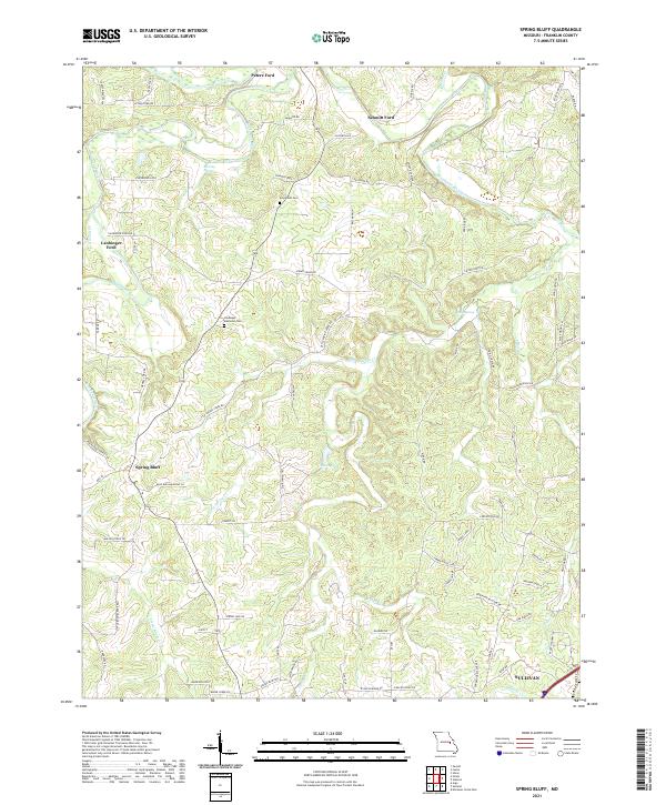
2021 Map of Spring Bluff
USGS Topo · Published 2021About this map
The Bourbeuse River winds through the northern portion of this landscape, characterized by numerous river crossings and active natural springs. Small rural communities like Spring Bluff and the northwestern edge of Sullivan anchor the settlement patterns, while historical river access points such as Peters Ford, Schmitt Ford, and Laubinger Ford indicate the area's long-standing reliance on the waterway for transit. This terrain is notably defined by its hydrology, featuring named flows like Little Spring Cr and Winsel Cr, alongside significant water sources including Roaring Spring, Kratz Spring, and Sour Spring. Local family history is preserved at the Evergreen Cem and Laubinger Memorial Cem, which sit amidst a network of rural routes such as Pea Ridge RD and Peters Ford RD. The map illustrates a typical Ozark borderland where established homesteads and cemetery sites remain central to the community's geographic identity.
Find a feature on this map
84 named features on this map. Tap any name to fly to it.
Don’t see what you’re looking for? This feature index may not catch every label — zoom into the map to look around manually.
Map Details
Editions of this 2021 Spring Bluff Map
This is the sole edition of this map. No revisions or reprints were ever made.
Other maps of this area

1903 · Sullivan
USGS Topo · 1:125,000

1934 · Meramec State Park
USGS Topo · 1:24,000

1935 · Gerald
USGS Topo · 1:48,000

1937 · Meramec State Park
USGS Topo · 1:24,000

1941 · Gerald
USGS Topo · 1:62,500

1944 · Gerald
USGS Topo · 1:62,500

1946 · Union
USGS Topo · 1:62,500

1947 · Sullivan
USGS Topo · 1:62,500

1948 · Argo
USGS Topo · 1:24,000

1948 · Union
USGS Topo · 1:62,500