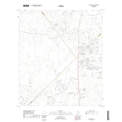
2019 Map of Spring Branch
USGS Topo · Published 2019About this map
The Guadalupe River and its network of tributaries, including Cypress Cr and Rebecca Cr, define the drainage patterns across this Hill Country landscape. The settlement of Spring Branch and the Spring Branch Springs serve as central points in a region where Blanco, Comal, and Kendall counties meet. To the north, the community of Twin Sisters sits near the headwaters of the Little Blanco River, surrounded by prominent terrain features like Long Ridge. The map illustrates a contemporary rural-residential transition, with established ranches and the Dean Ranch Airport existing alongside newer developments like Stallion Est. Navigating this topography are several critical thoroughfares, such as FM 473 and Farm Rd 473, which connect these dispersed settlements across the rugged Texas interior.
Find a feature on this map
120 named features on this map. Tap any name to fly to it.
Don’t see what you’re looking for? This feature index may not catch every label — zoom into the map to look around manually.
Map Details
Editions of this 2019 Spring Branch Map
This is the sole edition of this map. No revisions or reprints were ever made.
Other maps of this area

1887 · Blanco
USGS Topo · 1:125,000

1894 · Fredericksburg
USGS Topo · 1:125,000

1894 · Blanco
USGS Topo · 1:125,000

1920 · Smithsons Valley
USGS Topo · 1:62,500

1925 · Smithson Valley No. 1
USGS Topo · 1:48,000

1927 · Smithson Valley
USGS Topo · 1:62,500

1929 · Smithson Valley
USGS Topo · 1:62,500

1940 · Smithson Valley
USGS Topo · 1:62,500

1954 · Llano
USGS Topo · 1:250,000

1954 · San Antonio
USGS Topo · 1:250,000