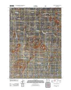
2011 Map of Spring Butte
USGS Topo · Published 2011About this map
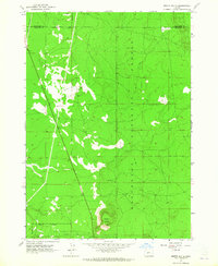
Spring Butte and several neighboring volcanic prominences rise above the forested high desert of central Oregon in this 2011 survey. The landscape is defined by its cinder cones, including Ipsoot Butte and Green Butte, which break the relatively level terrain of the surrounding Sand Flat. This high-altitude region is heavily patterned with a grid-like network of forest management roads, such as Sand Flats Rd and Nat For Dev Rd 300, reflecting decades of timber and fire management. A critical point of infrastructure in this arid environment is the Spring Butte Well, situated in a small clearing or camp area between the buttes. The map provides a detailed look at the specialized transportation network of the Natl Forest Develop Road 640 Rd, which facilitates access to these remote volcanic features and the open flats that separate them.
Find a feature on this map
17 named features on this map. Tap any name to fly to it.
Don’t see what you’re looking for? This feature index may not catch every label — zoom into the map to look around manually.
Map Details
Editions of this 2011 Spring Butte Map
This is the sole edition of this map. No revisions or reprints were ever made.
Other maps of this area

1931 · Newberry Crater
USGS Topo · 1:125,000

1935 · Newberry Crater
USGS Topo · 1:125,000

1955 · Crescent
USGS Topo · 1:250,000

1957 · Crescent
USGS Topo · 1:250,000

1958 · Crescent
USGS Topo · 1:250,000
1963 · Spring Butte
USGS Topo · 1:24,000
1963 · Finley Butte
USGS Topo · 1:24,000
1963 · Paulina Peak
USGS Topo · 1:24,000
1963 · Moffitt Butte
USGS Topo · 1:24,000

1970 · Crescent
USGS Topo · 1:250,000