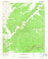
1967 Map of Spring Canyon
USGS Topo · Published 1971About this map
The Beaverhead Ranger Station and its adjacent Heliport serve as central points of activity within this high-elevation stretch of the Gila National Forest during the mid-1960s. The landscape is a complex network of drainages and mesas, where livestock management and water access are primary concerns. Evidence of ranching operations is found at the Slash Ranch and across various water improvements such as the Bear Canyon Windmill, Kennedy Windmill, and Indian Tank.
Find a feature on this map
36 named features on this map. Tap any name to fly to it.
Don’t see what you’re looking for? This feature index may not catch every label — zoom into the map to look around manually.
Map Details
Editions of this 1967 Spring Canyon Map
This is the sole edition of this map. No revisions or reprints were ever made.
Other maps of this area

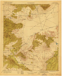
1911 · Alum Mountain
USGS Topo · 1:125,000

1913 · Alum Mountain
USGS Topo · 1:125,000
1918 · Pelona
USGS Topo · 1:125,000
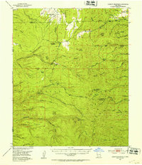
1949 · Lookout Mountain
USGS Topo · 1:62,500

1954 · Tularosa
USGS Topo · 1:250,000

1954 · Clifton
USGS Topo · 1:250,000

1957 · Clifton
USGS Topo · 1:250,000

1958 · Clifton
USGS Topo · 1:250,000

1958 · Tularosa
USGS Topo · 1:250,000

1962 · Clifton
USGS Topo · 1:250,000