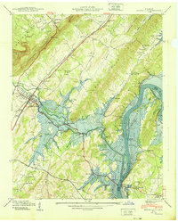
1940 Map of Spring City
USGS Topo · Published 1940About this map
Watts Bar Reservoir dominates this 1940 landscape, with blue stipple indicating the significant areas destined for submergence as the Tennessee Valley Authority modified the river valley. The settlement of Rhea Springs and its namesake Rhea Springs Cem sit directly in the path of the rising waters along Piney Creek, illustrating the profound transition of this community during the dam's construction. To the west, the Southern RR corridor supports the hub of Spring City, which remains above the projected waterline. The map meticulously records the rural infrastructure of the era, from the Mc Elwee Landing on the Tennessee River to numerous small educational and spiritual centers like Shady Grove Sch and Pinhook Ch. The topography rises sharply toward the Cumberland Escarpment and Walden Ridge, providing a stark contrast between the industrializing river basin and the high ground of Grandview.
Find a feature on this map
58 named features on this map. Tap any name to fly to it.
Don’t see what you’re looking for? This feature index may not catch every label — zoom into the map to look around manually.
Map Details
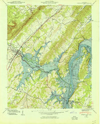
Editions of this 1940 Spring City Map
2 editions found
Other maps of this area

1887 · Kingston
USGS Topo · 1:125,000

1891 · Kingston
USGS Topo · 1:125,000

1893 · Kingston
USGS Topo · 1:125,000

1935 · Rockwood
USGS Topo · 1:24,000

1935 · Evensville
USGS Topo · 1:24,000

1935 · Decatur
USGS Topo · 1:24,000

1935 · Pennine
USGS Topo · 1:24,000

1936 · Roddy
USGS Topo · 1:24,000

1936 · Spring City
USGS Topo · 1:24,000
1936 · Grassy Cove
USGS Topo · 1:24,000