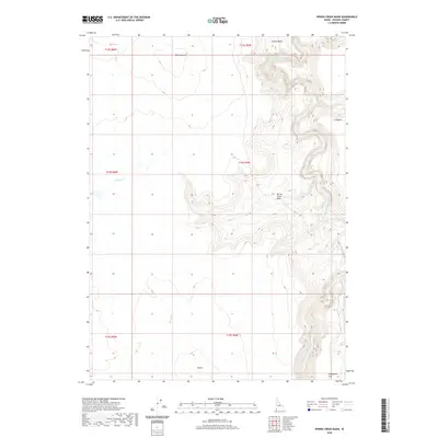
2020 Map of Spring Creek Basin
USGS Topo · Published 2020About this map
The South Fork Owyhee River cuts a deep path through the northeast corner of this high-desert plateau, where the drainage systems of Spring Cr and the Little Owyhee River define the arid landscape. The area is characterized by vast basins and isolated topographical markers, such as Spring-Butte and the distinctive 45 Hill.
Find a feature on this map
15 named features on this map. Tap any name to fly to it.
Don’t see what you’re looking for? This feature index may not catch every label — zoom into the map to look around manually.
Map Details
Editions of this 2020 Spring Creek Basin Map
This is the sole edition of this map. No revisions or reprints were ever made.
Other maps of this area

1955 · Jordan Valley
USGS Topo · 1:250,000

1957 · Jordan Valley
USGS Topo · 1:250,000

1958 · Jordan Valley
USGS Topo · 1:250,000

1973 · Coyote Hole
USGS Topo · 1:24,000

1973 · Red Basin
USGS Topo · 1:24,000

1973 · Grassy Ridge
USGS Topo · 1:24,000

1973 · Spring Creek Basin
USGS Topo · 1:24,000
1973 · Star Valley
USGS Topo · 1:24,000
1977 · Bull Basin Camp
USGS Topo · 1:24,000
1982 · Star Valley Knoll
USGS Topo · 1:24,000