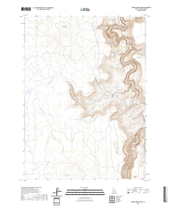
2023 Map of Spring Creek Basin
USGS Topo · Published 2023About this map
South Fork Owyhee Wild and Scenic River and the expansive Owyhee River Wilderness dominate this high-desert corner of Owyhee County. This 2023 survey by the U.S. Geological Survey details a landscape defined by deep canyons and flat-topped mesas where the South Fork Owyhee River meets the Little Owyhee River. The transition from the Y P Desert into the sunken drainage of the Spring Creek Basin illustrates the dramatic relief of the Owyhee Plateau, a region where water and erosion have carved intricate pathways through volcanic stone.
Find a feature on this map
17 named features on this map. Tap any name to fly to it.
Don’t see what you’re looking for? This feature index may not catch every label — zoom into the map to look around manually.
Map Details
Editions of this 2023 Spring Creek Basin Map
This is the sole edition of this map. No revisions or reprints were ever made.
Other maps of this area

1955 · Jordan Valley
USGS Topo · 1:250,000

1957 · Jordan Valley
USGS Topo · 1:250,000

1958 · Jordan Valley
USGS Topo · 1:250,000

1973 · Coyote Hole
USGS Topo · 1:24,000

1973 · Red Basin
USGS Topo · 1:24,000

1973 · Grassy Ridge
USGS Topo · 1:24,000

1973 · Spring Creek Basin
USGS Topo · 1:24,000
1973 · Star Valley
USGS Topo · 1:24,000
1977 · Bull Basin Camp
USGS Topo · 1:24,000
1982 · Star Valley Knoll
USGS Topo · 1:24,000