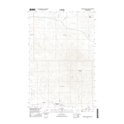
2017 Map of Spring Creek Junction
USGS Topo · Published 2017About this map
Spring Creek Junction serves as a focal point in this central Montana landscape, where the prairie begins its ascent into the foothills. The map reveals a complex system of water management vital to the local ranching economy, including the Bank Ranch Ditch and Lincoln Ditch, which redirect water across the northern sections. To the east and south, the terrain rises sharply into the North Moccasin Mountains and South Moccasin Mountains, creating a dramatic backdrop for the valley floor. The settlement of Kingston sits near the southern edge, connected by a network of rural routes such as Hanover Rd and Spring Creek Colony Rd. The course of Big Spring Cr and Warm Spring Cr illustrate the natural drainage patterns that have shaped land use and road placement throughout Fergus County.
Find a feature on this map
22 named features on this map. Tap any name to fly to it.
Don’t see what you’re looking for? This feature index may not catch every label — zoom into the map to look around manually.
Map Details
Editions of this 2017 Spring Creek Junction Map
This is the sole edition of this map. No revisions or reprints were ever made.
Other maps of this area

1941 · Lewistown
USGS Topo · 1:62,500

1944 · Lewistown
USGS Topo · 1:62,500

1954 · Lewistown
USGS Topo · 1:250,000

1959 · Lewistown
USGS Topo · 1:250,000

1970 · Danvers
USGS Topo · 1:24,000

1970 · Glengarry
USGS Topo · 1:24,000

1970 · Spring Creek Junction
USGS Topo · 1:24,000
1970 · Ross Fork
USGS Topo · 1:24,000

1978 · Toney Bench
USGS Topo · 1:24,000

1978 · Seventytwo Hills
USGS Topo · 1:24,000