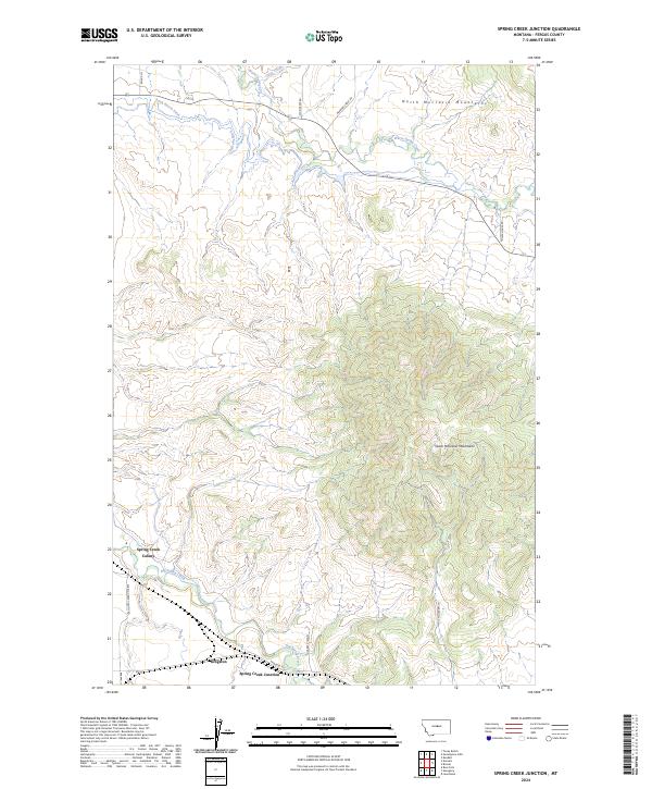
2024 Map of Spring Creek Junction
USGS Topo · Published 2024About this map
North Moccasin Mountains and the South Moccasin Mountains dominate this central Montana landscape, where the high-altitude terrain gives way to a network of managed water systems and valley settlements. The agricultural character of the region is defined by irrigation works such as the Bank Ranch Ditch and Lincoln Ditch, which divert water from the Warm Spring Creek and Duck Creek drainages to support the surrounding ranchlands.
Find a feature on this map
22 named features on this map. Tap any name to fly to it.
Don’t see what you’re looking for? This feature index may not catch every label — zoom into the map to look around manually.
Map Details
Editions of this 2024 Spring Creek Junction Map
This is the sole edition of this map. No revisions or reprints were ever made.
Other maps of this area

1941 · Lewistown
USGS Topo · 1:62,500

1944 · Lewistown
USGS Topo · 1:62,500

1954 · Lewistown
USGS Topo · 1:250,000

1959 · Lewistown
USGS Topo · 1:250,000

1970 · Danvers
USGS Topo · 1:24,000

1970 · Glengarry
USGS Topo · 1:24,000

1970 · Spring Creek Junction
USGS Topo · 1:24,000
1970 · Ross Fork
USGS Topo · 1:24,000

1978 · Toney Bench
USGS Topo · 1:24,000

1978 · Seventytwo Hills
USGS Topo · 1:24,000