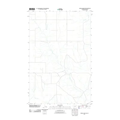
2011 Map of Spring Creek SW
USGS Topo · Published 2011About this map
Tomato Can Creek meanders through this portion of the Frazer District in Valley County, forming the primary drainage network for the surrounding grasslands. This 2011 survey illustrates a sparse, rural landscape defined by wide-open terrain and a modest system of local roads. The hydrological pattern is dominated by the branching tributaries of Tomato Can Creek and Sargent Creek, which provide essential water sources for this arid region of Montana. Human infrastructure is limited to established rural routes such as Daley Rd and Brandt Rd, which connect the isolated homesteads and ranching tracts common to the eastern part of the state. The map reveals the relationship between water and transport in a vast environment where secondary roads often follow the natural contours established by the creek beds.
Find a feature on this map
5 named features on this map. Tap any name to fly to it.
Don’t see what you’re looking for? This feature index may not catch every label — zoom into the map to look around manually.
Map Details
Editions of this 2011 Spring Creek SW Map
This is the sole edition of this map. No revisions or reprints were ever made.
Other maps of this area

1914 · Nashua
USGS Topo · 1:62,500

1915 · Frazer
USGS Topo · 1:62,500

1915 · Spring Creek
USGS Topo · 1:62,500

1916 · Nashua
USGS Topo · 1:62,500

1918 · Porcupine Valley
USGS Topo · 1:62,500

1954 · Glasgow
USGS Topo · 1:250,000

1957 · Glasgow
USGS Topo · 1:250,000

1958 · Glasgow
USGS Topo · 1:250,000
1972 · Dubbe Reservoir
USGS Topo · 1:24,000
1972 · Milk River Coulee
USGS Topo · 1:24,000