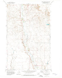
1972 Map of Dubbe Reservoir
USGS Topo · Published 1975About this map
Little Porcupine Creek meanders through this Valley County landscape, defining a drainage system that includes Johnson Coulee and Oswego Creek. During this early 1970s survey, the area reflects a sparsely populated ranching or agricultural environment characterized by essential water infrastructure and storage facilities. Smaller water bodies like Horgan Reservoir and the namesake Dubbe Reservoir are critical focal points in an otherwise arid expanse, joined by numerous named Spring and Springs locations.
Find a feature on this map
14 named features on this map. Tap any name to fly to it.
Don’t see what you’re looking for? This feature index may not catch every label — zoom into the map to look around manually.
Map Details
Editions of this 1972 Dubbe Reservoir Map
This is the sole edition of this map. No revisions or reprints were ever made.
Other maps of this area

1910 · Todd Lakes
USGS Topo · 1:62,500

1915 · Frazer
USGS Topo · 1:62,500

1915 · Oswego
USGS Topo · 1:62,500

1915 · Todd Lakes
USGS Topo · 1:62,500

1915 · Spring Creek
USGS Topo · 1:62,500

1954 · Wolf Point
USGS Topo · 1:250,000

1954 · Glasgow
USGS Topo · 1:250,000

1957 · Glasgow
USGS Topo · 1:250,000

1958 · Wolf Point
USGS Topo · 1:250,000

1958 · Glasgow
USGS Topo · 1:250,000