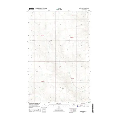
2014 Map of Spring Creek SW
USGS Topo · Published 2014About this map
Tomato Can Cr meanders through this portion of Valley County, defining the drainage patterns across the northern plains. The landscape is characterized by its distinct prairie coulees, most notably the wide Milk River Coulee that stretches across the southern sections. This area of Montana remains largely defined by its rural road network, with routes like Daley Rd and Brandt Rd providing the primary access points across the open terrain. The mapping focuses on the hydrology of the region, tracing the paths of Spring Cr and Sargent Cr as they navigate the subtle elevation changes. This survey provides a clear view of the land partitions and natural watercourses that have shaped ranching and land use in the Frazer District for generations.
Find a feature on this map
10 named features on this map. Tap any name to fly to it.
Don’t see what you’re looking for? This feature index may not catch every label — zoom into the map to look around manually.
Map Details
Editions of this 2014 Spring Creek SW Map
This is the sole edition of this map. No revisions or reprints were ever made.
Other maps of this area

1914 · Nashua
USGS Topo · 1:62,500

1915 · Frazer
USGS Topo · 1:62,500

1915 · Spring Creek
USGS Topo · 1:62,500

1916 · Nashua
USGS Topo · 1:62,500

1918 · Porcupine Valley
USGS Topo · 1:62,500

1954 · Glasgow
USGS Topo · 1:250,000

1957 · Glasgow
USGS Topo · 1:250,000

1958 · Glasgow
USGS Topo · 1:250,000
1972 · Dubbe Reservoir
USGS Topo · 1:24,000
1972 · Milk River Coulee
USGS Topo · 1:24,000