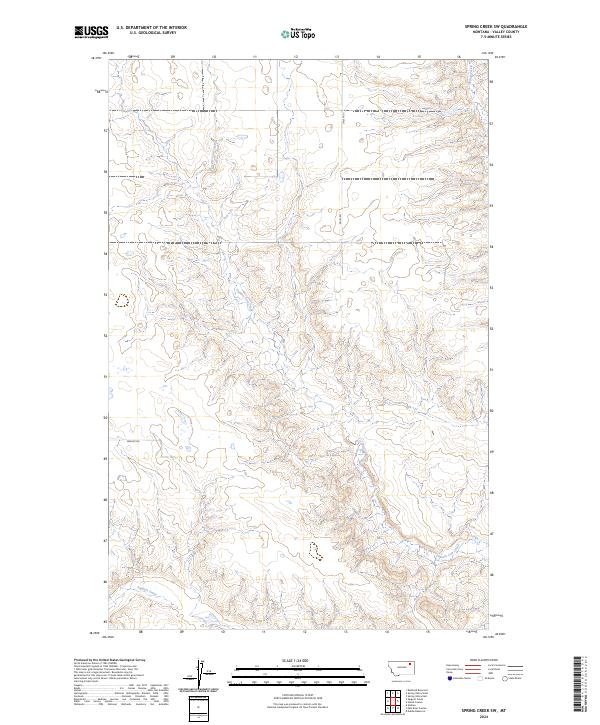
2024 Map of Spring Creek SW
USGS Topo · Published 2024About this map
Tomato Can Creek and Sargent Creek carve through the high plains of Valley County in this modern topographic study. The landscape is defined by its drainage patterns and the systematic grid of the Public Land Survey System, with the terrain rising toward the northeast near Spring Creek. While much of the area remains open and undeveloped, rural access is maintained by routes like Daley Rd and Brandt Rd. The map illustrates a contemporary view of Montana's rangeland, showing how historical township boundaries like t30n r42e and t29n r43e continue to organize this sparsely populated region of the northern Missouri River watershed.
Find a feature on this map
9 named features on this map. Tap any name to fly to it.
Don’t see what you’re looking for? This feature index may not catch every label — zoom into the map to look around manually.
Map Details
Editions of this 2024 Spring Creek SW Map
This is the sole edition of this map. No revisions or reprints were ever made.
Other maps of this area

1914 · Nashua
USGS Topo · 1:62,500

1915 · Frazer
USGS Topo · 1:62,500

1915 · Spring Creek
USGS Topo · 1:62,500

1916 · Nashua
USGS Topo · 1:62,500

1918 · Porcupine Valley
USGS Topo · 1:62,500

1954 · Glasgow
USGS Topo · 1:250,000

1957 · Glasgow
USGS Topo · 1:250,000

1958 · Glasgow
USGS Topo · 1:250,000
1972 · Dubbe Reservoir
USGS Topo · 1:24,000
1972 · Milk River Coulee
USGS Topo · 1:24,000