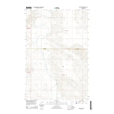
2014 Map of Spring Draw
USGS Topo · Published 2014About this map
The Powder River meanders through the heart of this landscape along the border of Prairie Co and Custer Co, shaping the drainage patterns for numerous small creeks. The terrain is defined by the significant topographic feature Spring Draw, which cuts through the central portion of the quadrangle. Transportation is limited to remote corridors such as N Locate Rd and Ten Mile Rd, which provide access to the vast ranchlands and open range of eastern Montana. This survey reveals a complex network of seasonal waterways feeding into the main river valley, including Maggie Cr, Corral Cr, and Deep Cr. The map is particularly useful for identifying family-named geographic markers such as Louie Cr and Freddie Cr, which often reflect historical land ownership and early homesteading patterns in this sparsely populated region.
Find a feature on this map
15 named features on this map. Tap any name to fly to it.
Don’t see what you’re looking for? This feature index may not catch every label — zoom into the map to look around manually.
Map Details
Editions of this 2014 Spring Draw Map
This is the sole edition of this map. No revisions or reprints were ever made.
Other maps of this area

1953 · Miles City
USGS Topo · 1:250,000

1957 · Miles City
USGS Topo · 1:250,000

1958 · Miles City
USGS Topo · 1:250,000

1969 · Corral Butte
USGS Topo · 1:24,000

1969 · Spring Draw
USGS Topo · 1:24,000

1969 · Zero NE
USGS Topo · 1:24,000

1969 · Zero
USGS Topo · 1:24,000

1969 · Hogan Creek
USGS Topo · 1:24,000

1969 · Flat Top Butte SW
USGS Topo · 1:24,000

1969 · Buck Mountain
USGS Topo · 1:24,000