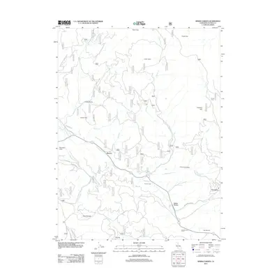
2012 Map of Spring Garden
USGS Topo · Published 2012About this map
Spring Garden serves as a central point in this Plumas County landscape, where the Western Pacific rail corridor maneuvers through the mountains via the Spring Garden Tunnel. The settlement pattern follows the drainage of Greenhorn Cr, with small mountain communities like Massack and Greenhorn positioned along the creek valleys. The terrain is marked by prominent high points such as Taylor Rock, Tower Rock, and Argentine Rock, which oversee a network of Forest Service roads including Mount Hough Crystal Lake Rd. To the south, Lee Summit and Fells Flat illustrate the high-elevation flats and meadows, like Cutter Meadow, that define the local geography. The map documents a rugged timber and transit corridor, highlighting the connection between narrow mountain valleys such as Thompson Valley and Pine Creek Valley and the established routes like La Porte Rd and Greenhorn Ranch Rd.
Find a feature on this map
32 named features on this map. Tap any name to fly to it.
Don’t see what you’re looking for? This feature index may not catch every label — zoom into the map to look around manually.
Map Details
Editions of this 2012 Spring Garden Map
This is the sole edition of this map. No revisions or reprints were ever made.
Other maps of this area

1886 · Honey Lake
USGS Topo · 1:250,000

1891 · Downieville
USGS Topo · 1:125,000

1891 · Honey Lake
USGS Topo · 1:250,000

1893 · Honey Lake
USGS Topo · 1:250,000

1893 · Downieville
USGS Topo · 1:125,000

1895 · Downieville
USGS Topo · 1:125,000

1896 · Downieville
USGS Topo · 1:125,000

1897 · Downieville
USGS Topo · 1:125,000

1937 · Blairsden
USGS Topo · 1:48,000

1943 · Blairsden
USGS Topo · 1:62,500