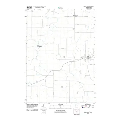
2010 Map of Spring Grove
USGS Topo · Published 2010About this map
Spring Grove serves as the primary hub in this corner of Houston County, where the driftless-style terrain is defined by the winding paths of Beaver Creek West and North Bear Creek. The landscape is dotted with small, historic communities like Black Hammer and Newhouse, each maintaining its own distinct identity through local institutions such as the Black Hammer Lutheran Church and its accompanying cemetery. For those tracing family history, the map provides precise locations for several burial grounds including Saint Marys Cemetery, Riceford Norwegian Cemetery, and Bellview Cemetery. The rural character is further emphasized by small-scale aviation sites like Deters Farms Airport and Sylling Landing Field, while the topography rises significantly at Black Hammer Bluff. Transportation routes such as Old Indian Trail Rd and Stage Rd hint at the area's older transit corridors that long predated modern highway designations.
Find a feature on this map
60 named features on this map. Tap any name to fly to it.
Don’t see what you’re looking for? This feature index may not catch every label — zoom into the map to look around manually.
Map Details
Editions of this 2010 Spring Grove Map
This is the sole edition of this map. No revisions or reprints were ever made.
Other maps of this area

1906 · Decorah
USGS Topo · 1:125,000

1958 · La Crosse
USGS Topo · 1:250,000

1961 · La Crosse
USGS Topo · 1:250,000

1965 · La Crosse
USGS Topo · 1:250,000

1965 · Wilmington
USGS Topo · 1:24,000

1965 · Mabel
USGS Topo · 1:24,000

1965 · Spring Grove
USGS Topo · 1:24,000

1965 · Sheldon
USGS Topo · 1:24,000

1965 · Yucatan
USGS Topo · 1:24,000

1965 · Bratsberg
USGS Topo · 1:24,000