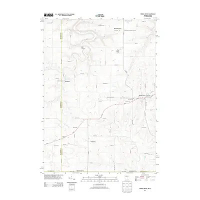
2013 Map of Spring Grove
USGS Topo · Published 2013About this map
Spring Grove serves as the primary hub in this corner of Houston County, where MN-44 connects small rural communities across a landscape defined by deep valleys and high bluffs. The settlement patterns reflect a strong Norwegian heritage, evidenced by the cluster of religious sites such as the Riceford Norwegian Cem and the Spring Grove Lutheran Cem. To the north, the terrain rises toward Black Hammer Bluff, overlooking the scattered farmsteads of Black Hammer. Waterways like Riceford Cr and Beaver Cr West carve through the topography, influencing the placement of historical roads and early settlements like Newhouse. The presence of several distinct burial grounds, including Holy Trinity Cem and the Old Black Hammer Cem, provides a detailed record of the families who established these townships. Local infrastructure is further detailed by features like the Deters Farms Airport and the Supersaw Valley Campground.
Find a feature on this map
79 named features on this map. Tap any name to fly to it.
Don’t see what you’re looking for? This feature index may not catch every label — zoom into the map to look around manually.
Map Details
Editions of this 2013 Spring Grove Map
This is the sole edition of this map. No revisions or reprints were ever made.
Other maps of this area

1906 · Decorah
USGS Topo · 1:125,000

1958 · La Crosse
USGS Topo · 1:250,000

1961 · La Crosse
USGS Topo · 1:250,000

1965 · La Crosse
USGS Topo · 1:250,000

1965 · Wilmington
USGS Topo · 1:24,000

1965 · Mabel
USGS Topo · 1:24,000

1965 · Spring Grove
USGS Topo · 1:24,000

1965 · Sheldon
USGS Topo · 1:24,000

1965 · Yucatan
USGS Topo · 1:24,000

1965 · Bratsberg
USGS Topo · 1:24,000