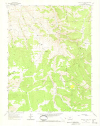
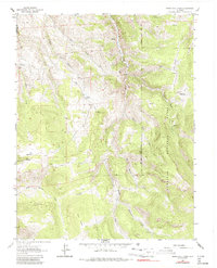
1962 Map of Spring Hill Creek
USGS Topo · Published 1973About this map
The Gunnison National Forest dominates this high-altitude landscape of Saguache and Gunnison counties, defined by a complex network of resource extraction and seasonal grazing. Evidence of early mineral interest is found in the Continental Mine and Midland Mine, while various unnamed prospects are scattered across the western slopes of Black Ridge. The human footprint is concentrated around several historic landholdings and camps, including the Shelton Ranch along South Beaver Creek and the Mergelmann Cow Camp. Water sources are critical in this terrain, as seen in the named springs and high-basin features like Big Mud Pond and Little Mud Pond. Movement through the drainage systems of Willow Creek and Sugar Creek is primarily facilitated by established trails and rugged jeep trails that connect the isolated Watts Homestead to the higher ridgelines and timbered parks.
Find a feature on this map
29 named features on this map. Tap any name to fly to it.
Don’t see what you’re looking for? This feature index may not catch every label — zoom into the map to look around manually.
Map Details
Editions of this 1962 Spring Hill Creek Map
5 editions found
Other maps of this area

1908 · Uncompahgre
USGS Topo · 1:125,000

1911 · Uncompahgre
USGS Topo · 1:125,000

1954 · Iris NW
USGS Topo · 1:24,000

1954 · Iola
USGS Topo · 1:24,000

1956 · Montrose
USGS Topo · 1:250,000

1959 · Montrose
USGS Topo · 1:250,000

1960 · Montrose
USGS Topo · 1:250,000

1962 · Rudolph Hill
USGS Topo · 1:24,000

1962 · Iris
USGS Topo · 1:24,000

1962 · Powderhorn
USGS Topo · 1:24,000