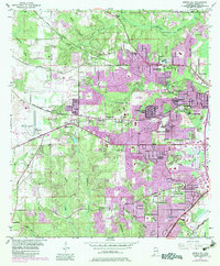
1953 Map of Spring Hill
USGS Topo · Published 1983About this map
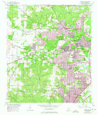
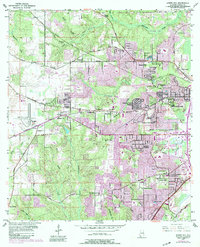
The western suburbs of Mobile are captured here in a period of significant mid-century expansion, centered on the campus of Spring Hill College and the growing University of South Alabama. To the west, Bates Field serves as a major aviation landmark, while the surrounding landscape transitions from organized residential developments like Country Club Village and Jackson Heights into more rural creek valleys. These waterways, including Threemile Creek and Twelvemile Creek, carve through the terrain, historically shaping the layout of early routes like the Old Spanish Trail. Local infrastructure is well-defined, ranging from the Mobile Waterworks and Blenville Reservoir to specialized facilities such as the State Fish Hatchery and County Sanitarium. The map also documents numerous neighborhood institutions, including Vincent Chapel, New Hope Ch, and Cottage Hill Sch, providing a detailed record of the community's social and educational geography during this era.
Find a feature on this map
77 named features on this map. Tap any name to fly to it.
Don’t see what you’re looking for? This feature index may not catch every label — zoom into the map to look around manually.
Map Details
Editions of this 1953 Spring Hill Map
6 editions found
Other maps of this area

1922 · Mobile
USGS Topo · 1:62,500

1940 · Hollingers Island
USGS Topo · 1:31,680

1940 · Mobile
USGS Topo · 1:31,680

1940 · Mobile
USGS Topo · 1:62,500

1941 · Chickasaw
USGS Topo · 1:31,680

1941 · Hurley
USGS Topo · 1:62,500

1941 · Creola
USGS Topo · 1:62,500

1942 · Kushla
USGS Topo · 1:31,680

1942 · Theodore
USGS Topo · 1:31,680

1942 · Wilmer
USGS Topo · 1:62,500