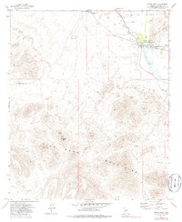
1973 Map of Spring Mtn.
USGS Topo · Published 1986About this map
Gillespie Dam stands as a central industrial landmark on the Gila River, marking a point of intensive water management in the arid desert landscape. This 1970s survey captures the complex irrigation infrastructure including the Enterprise Canal and Eighty Canal which divert water toward the Arlington Valley. The surrounding terrain is defined by the Gila Bend Mountains and the Buckeye Hills, where mining activity is evident at the Buckeye Copper Mine and various scattered prospect sites.
Find a feature on this map
23 named features on this map. Tap any name to fly to it.
Don’t see what you’re looking for? This feature index may not catch every label — zoom into the map to look around manually.
Map Details
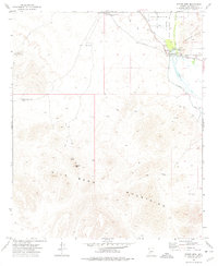
Editions of this 1973 Spring Mtn. Map
2 editions found
Other maps of this area

1951 · Cotton Center
USGS Topo · 1:62,500

1951 · Woolsey Peak
USGS Topo · 1:62,500

1954 · Phoenix
USGS Topo · 1:250,000

1957 · Phoenix
USGS Topo · 1:250,000

1958 · Phoenix
USGS Topo · 1:250,000

1958 · Hassayampa
USGS Topo · 1:24,000

1958 · Buckeye
USGS Topo · 1:62,500

1960 · Phoenix
USGS Topo · 1:250,000

1962 · Arlington
USGS Topo · 1:62,500

1969 · Phoenix
USGS Topo · 1:250,000