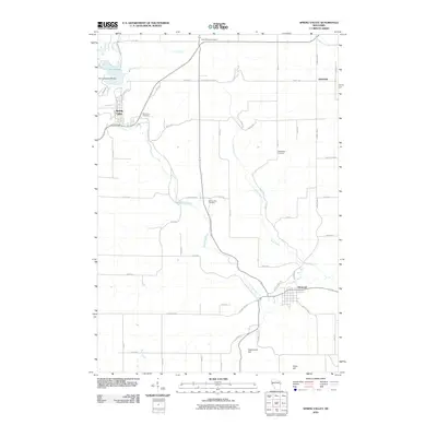
2010 Map of Spring Valley
USGS Topo · Published 2010About this map
Spring Valley and Elmwood anchor this 2010 topographic survey of western Wisconsin, where the Eau Galle River and its tributaries have carved a distinct drainage pattern through the uplands. The northern reaches are marked by Lake George and the engineering of the Eau Galle E30:184 Dam, while the rural landscape to the east and south is dotted with small settlements like Hatchville.
Find a feature on this map
51 named features on this map. Tap any name to fly to it.
Don’t see what you’re looking for? This feature index may not catch every label — zoom into the map to look around manually.
Map Details
Editions of this 2010 Spring Valley Map
This is the sole edition of this map. No revisions or reprints were ever made.
Other maps of this area

1935 · Arkansaw
USGS Topo · 1:48,000

1940 · Maiden Rock
USGS Topo · 1:62,500

1941 · Arkansaw
USGS Topo · 1:62,500

1942 · Arkansaw
USGS Topo · 1:62,500

1946 · Knapp
USGS Topo · 1:62,500

1949 · Knapp
USGS Topo · 1:62,500

1949 · Baldwin
USGS Topo · 1:62,500

1950 · Maiden Rock
USGS Topo · 1:62,500

1953 · Saint Paul
USGS Topo · 1:250,000

1959 · Saint Paul
USGS Topo · 1:250,000