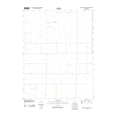
2009 Map of Spring Valley Ranch
USGS Topo · Published 2009About this map
Spring Valley Ranch sits at the center of this High Plains landscape in Wallace County, defining a region characterized by expansive rangeland and intermittent watercourses. The drainage patterns of Eagletail Creek and the Ladder Creek system illustrate the hydrology of the western Kansas prairie, where water is a critical resource for agricultural operations. The map reveals a strictly organized grid of rural routes, including Wa W-M and RD Wa-W-J, which provide access to isolated ranch outposts and grazing lands. Along the eastern edge, State Hwy 27 serves as the primary north-south artery, connecting the local ranching economy to the wider region. The confluence of branches like the North Fork Middle Ladder Creek highlights the subtle topographic variations that dictate land use in this open country.
Find a feature on this map
21 named features on this map. Tap any name to fly to it.
Don’t see what you’re looking for? This feature index may not catch every label — zoom into the map to look around manually.
Map Details
Editions of this 2009 Spring Valley Ranch Map
This is the sole edition of this map. No revisions or reprints were ever made.
Other maps of this area

1955 · Scott City
USGS Topo · 1:250,000

1958 · Scott City
USGS Topo · 1:250,000

1959 · Weskan
USGS Topo · 1:62,500

1959 · Wallace
USGS Topo · 1:62,500

1968 · Sharon Springs 3 NE
USGS Topo · 1:24,000

1968 · Sharon Springs 4 NW
USGS Topo · 1:24,000

1968 · Sharon Springs 3 NW
USGS Topo · 1:24,000
1979 · Sharon Springs West
USGS Topo · 1:24,000
1979 · Spring Valley Ranch
USGS Topo · 1:24,000
1979 · Sharon Springs East
USGS Topo · 1:24,000