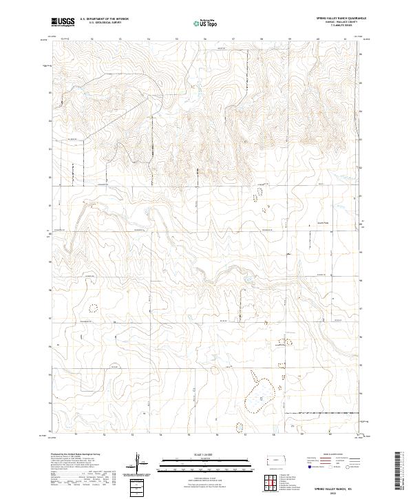
2022 Map of Spring Valley Ranch
USGS Topo · Published 2022About this map
The expansive high plains of Wallace County are defined here by the open terrain of South Flats, a landscape etched by the intermittent drainages of the Smoky Hill River watershed. Watercourses such as Eaglehead Cr, Rose Cr, and the N Fork Rose Cr cut shallow paths through the prairie, providing the primary relief in an otherwise level expanse. The layout of the land is dictated by a strict grid of section lines and gravel paths, where the remote character of western Kansas is reflected in the utilitarian naming of the local infrastructure.
Find a feature on this map
18 named features on this map. Tap any name to fly to it.
Don’t see what you’re looking for? This feature index may not catch every label — zoom into the map to look around manually.
Map Details
Editions of this 2022 Spring Valley Ranch Map
This is the sole edition of this map. No revisions or reprints were ever made.
Other maps of this area

1955 · Scott City
USGS Topo · 1:250,000

1958 · Scott City
USGS Topo · 1:250,000

1959 · Weskan
USGS Topo · 1:62,500

1959 · Wallace
USGS Topo · 1:62,500

1968 · Sharon Springs 3 NE
USGS Topo · 1:24,000

1968 · Sharon Springs 4 NW
USGS Topo · 1:24,000

1968 · Sharon Springs 3 NW
USGS Topo · 1:24,000
1979 · Sharon Springs West
USGS Topo · 1:24,000
1979 · Spring Valley Ranch
USGS Topo · 1:24,000
1979 · Sharon Springs East
USGS Topo · 1:24,000