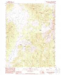
1990 Map of Spring Valley Summit
USGS Topo · Published 1990About this map
Mountain Boy Range and the northern reaches of the Fish Creek mountains dominate this high-desert Nevada landscape, where historical mining activity is etched into the steep canyons. Significant silver and base metal operations appear as clusters of activity, including the Mountain Boy Mine, Kentucky Mine, and Silver Conner Mine near the northern boundary. The terrain is marked by a network of unimproved roads and trails that connect isolated water sources like Josephine Spring and McCulloughs Spring to high-elevation points such as Spring Valley Summit and Atrypa Peak.
Find a feature on this map
41 named features on this map. Tap any name to fly to it.
Don’t see what you’re looking for? This feature index may not catch every label — zoom into the map to look around manually.
Map Details
Editions of this 1990 Spring Valley Summit Map
This is the sole edition of this map. No revisions or reprints were ever made.
Other maps of this area

1926 · Roberts Mountains
USGS Topo · 1:250,000

1929 · Roberts Mountains
USGS Topo · 1:250,000

1953 · Pinto Summit
USGS Topo · 1:62,500

1953 · Eureka
USGS Topo · 1:62,500

1955 · Millett
USGS Topo · 1:250,000

1956 · Bellevue Peak
USGS Topo · 1:62,500

1956 · Whistler Mtn
USGS Topo · 1:62,500

1956 · Ely
USGS Topo · 1:250,000

1959 · Ely
USGS Topo · 1:250,000

1959 · Millett
USGS Topo · 1:250,000