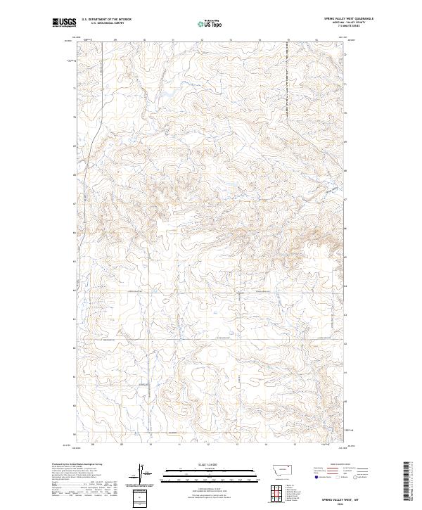
2024 Map of Spring Valley West
USGS Topo · Published 2024About this map
Tomato Can Creek and Spring Creek thread through this section of Valley County, defining a landscape of northern Montana coulees and drainages. The map reveals a systematic grid of section lines and rural thoroughfares that speak to the region's agricultural foundations. Roads such as Grain East Rd, Lustre Grain Rd, and Grain School Rd indicate the historical importance of the local harvest and the decentralized community structure common to these expansive plains.
Find a feature on this map
18 named features on this map. Tap any name to fly to it.
Don’t see what you’re looking for? This feature index may not catch every label — zoom into the map to look around manually.
Map Details
Editions of this 2024 Spring Valley West Map
This is the sole edition of this map. No revisions or reprints were ever made.
Other maps of this area

1915 · Spring Creek
USGS Topo · 1:62,500

1918 · Porcupine Valley
USGS Topo · 1:62,500

1954 · Glasgow
USGS Topo · 1:250,000

1957 · Glasgow
USGS Topo · 1:250,000

1958 · Glasgow
USGS Topo · 1:250,000

1973 · Baylor SE
USGS Topo · 1:24,000

1973 · Larslan
USGS Topo · 1:24,000
1973 · Blink Springs
USGS Topo · 1:24,000
1983 · Spring Valley East
USGS Topo · 1:24,000
1983 · Spring Creek SW
USGS Topo · 1:24,000