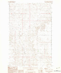
1983 Map of Spring Valley East
USGS Topo · Published 1983About this map
Little Porcupine Creek and its various forks define this portion of Valley County, where the high plains transition into a complex drainage system. This 1983 provisional survey highlights the intricate land divisions across townships T32N, T31N, and T30N, reflecting a landscape dominated by ranching and open range. Remote infrastructure is sparse, yet the presence of an Airstrip in the western reaches suggests the necessity of aerial access in this expansive Montana terrain. The confluence of the West Fork Spring Valley Fork and East Fork Spring Valley Fork provides a clear view of the natural watercourses that have historically shaped land use and navigation in the Fort Peck Indian Reservation area.
Find a feature on this map
9 named features on this map. Tap any name to fly to it.
Don’t see what you’re looking for? This feature index may not catch every label — zoom into the map to look around manually.
Map Details
Editions of this 1983 Spring Valley East Map
This is the sole edition of this map. No revisions or reprints were ever made.
Other maps of this area

1910 · Todd Lakes
USGS Topo · 1:62,500

1915 · Todd Lakes
USGS Topo · 1:62,500

1915 · Spring Creek
USGS Topo · 1:62,500

1954 · Wolf Point
USGS Topo · 1:250,000

1954 · Glasgow
USGS Topo · 1:250,000

1957 · Glasgow
USGS Topo · 1:250,000

1958 · Wolf Point
USGS Topo · 1:250,000

1958 · Glasgow
USGS Topo · 1:250,000

1973 · Larslan
USGS Topo · 1:24,000

1973 · Haugens Hill
USGS Topo · 1:24,000